
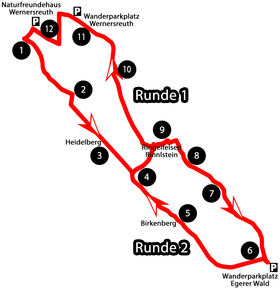
The “Rinnlstein” hike consists of two circular routes (1 and 2) which together form a big eight. It is 9.5 km long. It is best if you walk along the course following the direction of the arrows. You can start on each of the three parking lots.
Alternatively, you can follow the path following the numbers of the “Historical Points” from 1 to 12.
Depending on your physical condition, it is also possible to divide the twelve stations into two rounds.
 Info-flyer download:
 Info-Flyer_Rinnlstein-Rundweg.pdf (4.3 MiB, 1,768 hits)
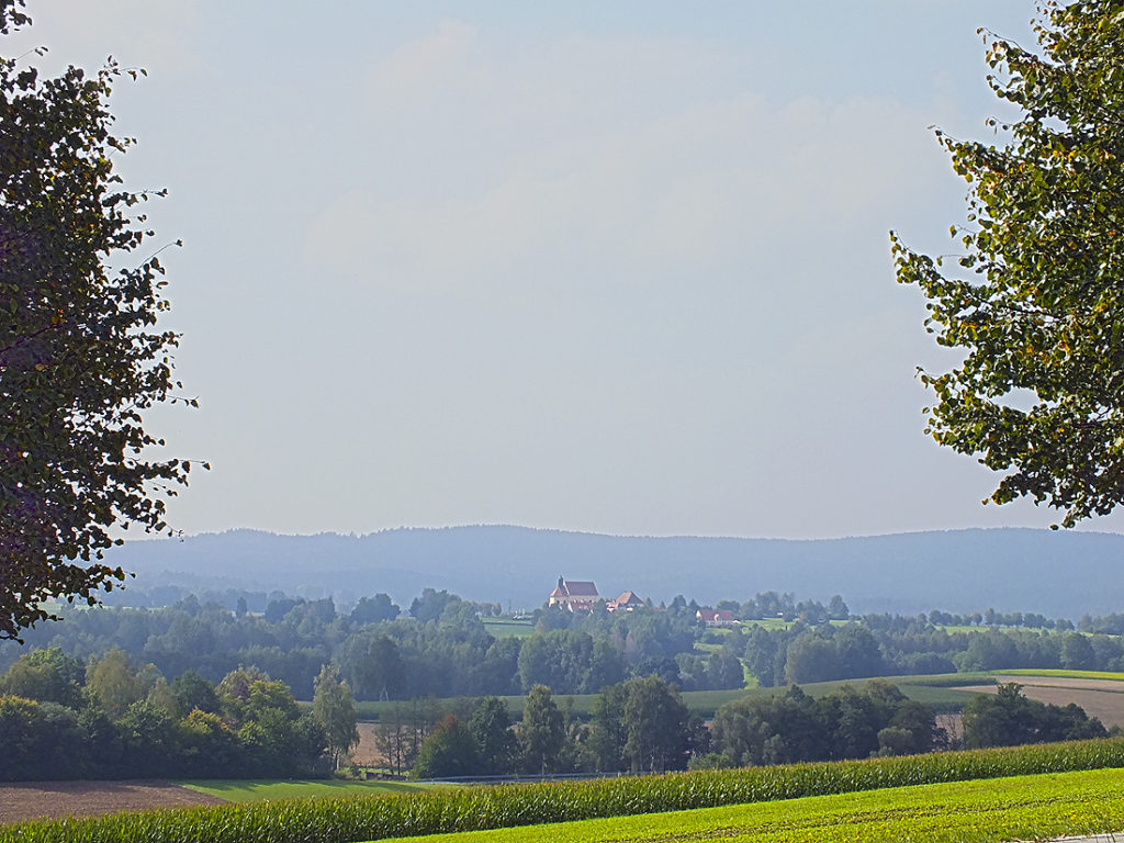
Der “Böhmische” – The Bohemian Wind (1)
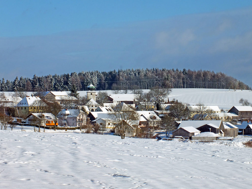
Like many other villages in the area of Bad Neualbenreuth, also Wernersreuth has a close connection to the monastery of Waldsassen. It was first documented in 1140 as “Wernherisrvte”. It lies 606 metres above sea level right in the middle of an ancient clearing area which slopes to the south. The ending “-reuth” derives from … Continue reading “Der “Böhmische” – The Bohemian Wind (1)”
Die Wasserspender – The Water Dispensers (2)
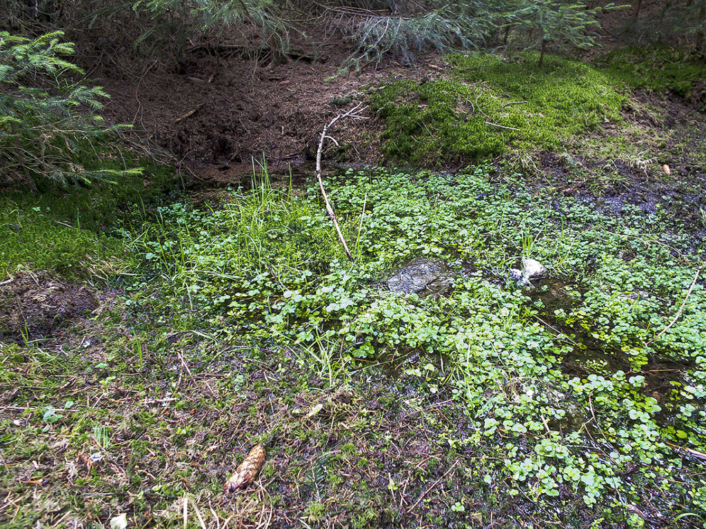
Around the “Birkenberg” and “Heidelberg” mountains you can find three productive spring grounds. The sources of the streams “Pointmühlbach” in the north-east, of the “Kornmühlbach” in the west and of the “Hendlmühlbach” in the south are supplied by the surface water of the wooded heights. On its way down, the surface water passes the slate … Continue reading “Die Wasserspender – The Water Dispensers (2)”
Am Heidelberg – On The “Heidelberg” mountain, 731 m (3)
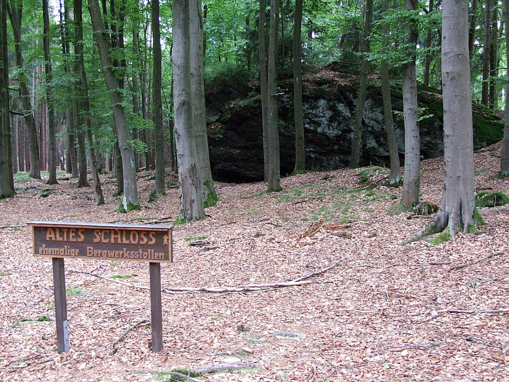
On the summit of the “Heidelberg” mountain, next to the rock formations, you can find the remains of old gold mining tunnels (“test galleries”). In the Middle Ages, Bad Neualbenreuth was known for its rich gold deposits. The gold mineralized in the quartz veins in the slate of the “Waldsassener Schiefergebirge” mountain range. In the … Continue reading “Am Heidelberg – On The “Heidelberg” mountain, 731 m (3)”
Die “Rainbuche” – The Beech On The Border (4)
Until several years ago, the “Rainbuche”, a mighty old beech, stood at this unimpressive place on the historic road on the saddle between the “Birken-“ and “Heidelberg” mountains. Beeches for themselves are not very important as a natural monument. More important are their significance as pre-eminent solitary tree and their importance as landmark. The “Rainbuche”, too, … Continue reading “Die “Rainbuche” – The Beech On The Border (4)”
Am Birkenberg – On the “Birkenberg” mountain, 744 m (5)
The “Birkenberg” (744 m) is the 1168th-highest mountain in Bavaria and the 1658th-,highest mountain in Germany. In the administrative area of Bad Neualbenreuth the “Birkenberg” is the third-highest mountain after the “Muglberg” and the “Grünhau”. Originally, the name of the whole mountain range, together with the “Heidelberg”, was called “Hedelberg”. The name goes back to … Continue reading “Am Birkenberg – On the “Birkenberg” mountain, 744 m (5)”
“Egerer Stadtwald” – A Bohemian Forest In Bavaria (6)
This 634-ha large woodland has been owned by the town of Eger since 1544. Historically, this situation goes back to the times of the so called “Fraisch”. Because of the disbanding of the Bavarian “Nordgau” region in the 14th century an area with overlapping legal and jurisdictional competences arose and, with it, persistent arguments between … Continue reading “”Egerer Stadtwald” – A Bohemian Forest In Bavaria (6)”
Die Köhlerplätze im Gutswald – The Charcoal Makers’ Sites In The Estate’s Forest (7)
Along the forest and hiking trail, on the slope gently descending to the northeast, flat round, but overgrown places can be discerned. On a few hundred meters, at least nine of them are lined up here. They are old sites of charcoal or maybe pitch kilns which partly were used until the beginning of the … Continue reading “Die Köhlerplätze im Gutswald – The Charcoal Makers’ Sites In The Estate’s Forest (7)”
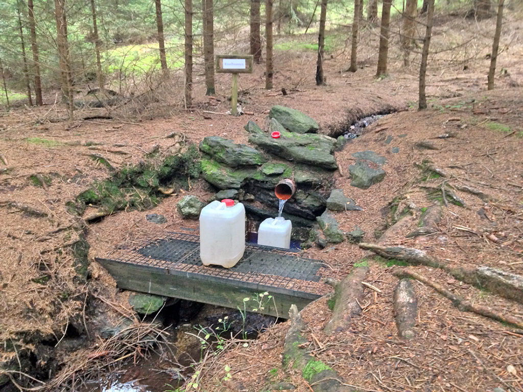
Das “Rinnl” – The Streamlet (8)
The small babbling streamlet rises only 30 meters higher, in the middle of the forest, at the so called “Rinnlbrunnen” (Rinnl well). Its source is one of the highest located springs of the whole ridge. In the Vienna State Treaty of 26 June 1862 it is described that “on the Tillenberg mountain the borderline was … Continue reading “Das “Rinnl” – The Streamlet (8)”
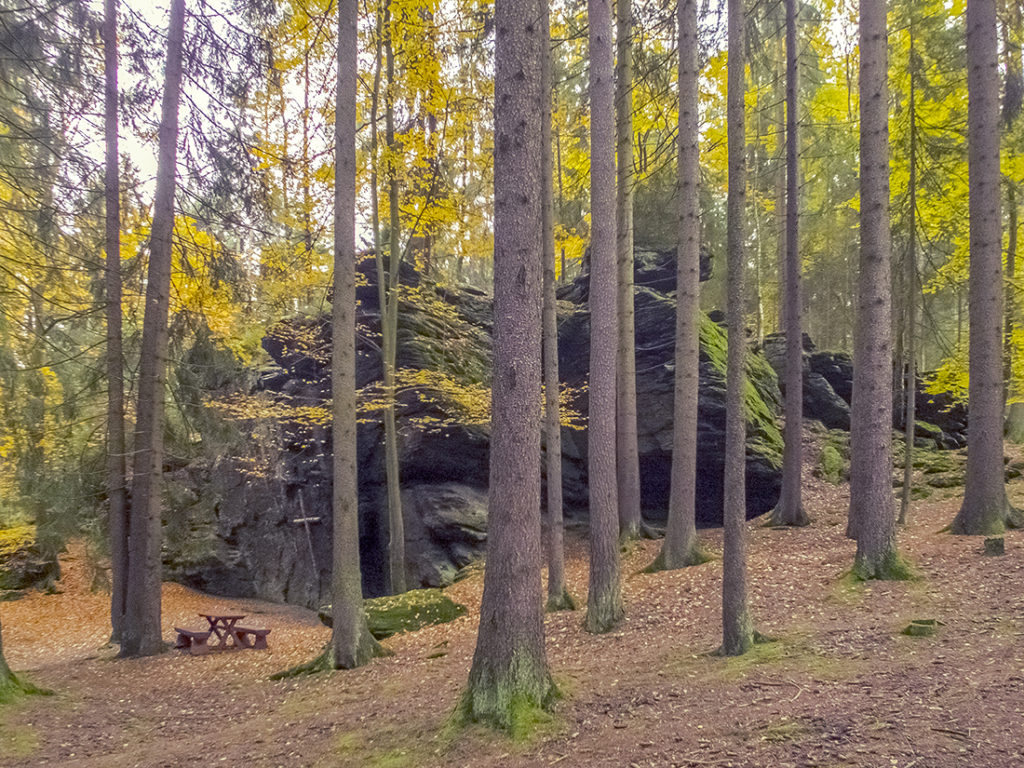
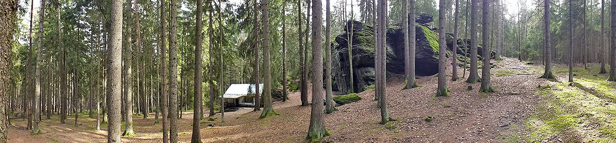
Ringelfelsen (Rinnlstein) – The “Ringel” Rock (“Rinnl” Stone), 653 m (9)
The “Ringelfelsen” (also “Rinnlstein” or “Ringelstein”), 653 meters above sea level, is the biggest rock formation in the local area and is part of the “Waldsassener Schiefergebirge” (slate mountains of Waldsassen). This Phyllites (metamorphic slates) were formed during the geological era of the Cambrian around 541 to 485,4 million years ago. In the east, they … Continue reading “Ringelfelsen (Rinnlstein) – The “Ringel” Rock (“Rinnl” Stone), 653 m (9)”
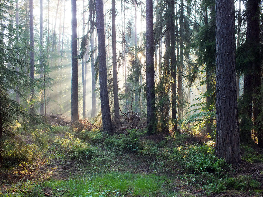
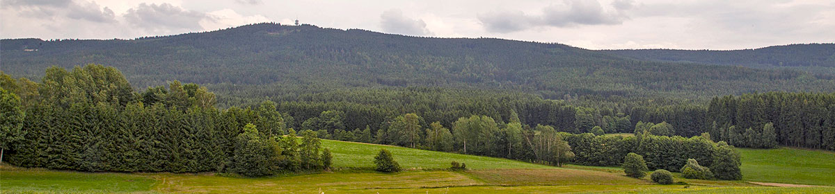
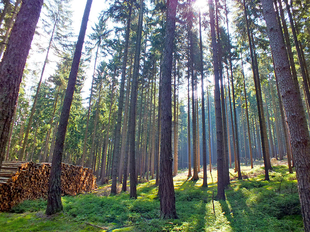
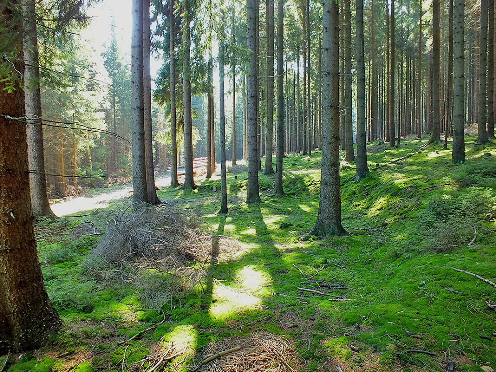
Der Wald – The Forest (10)
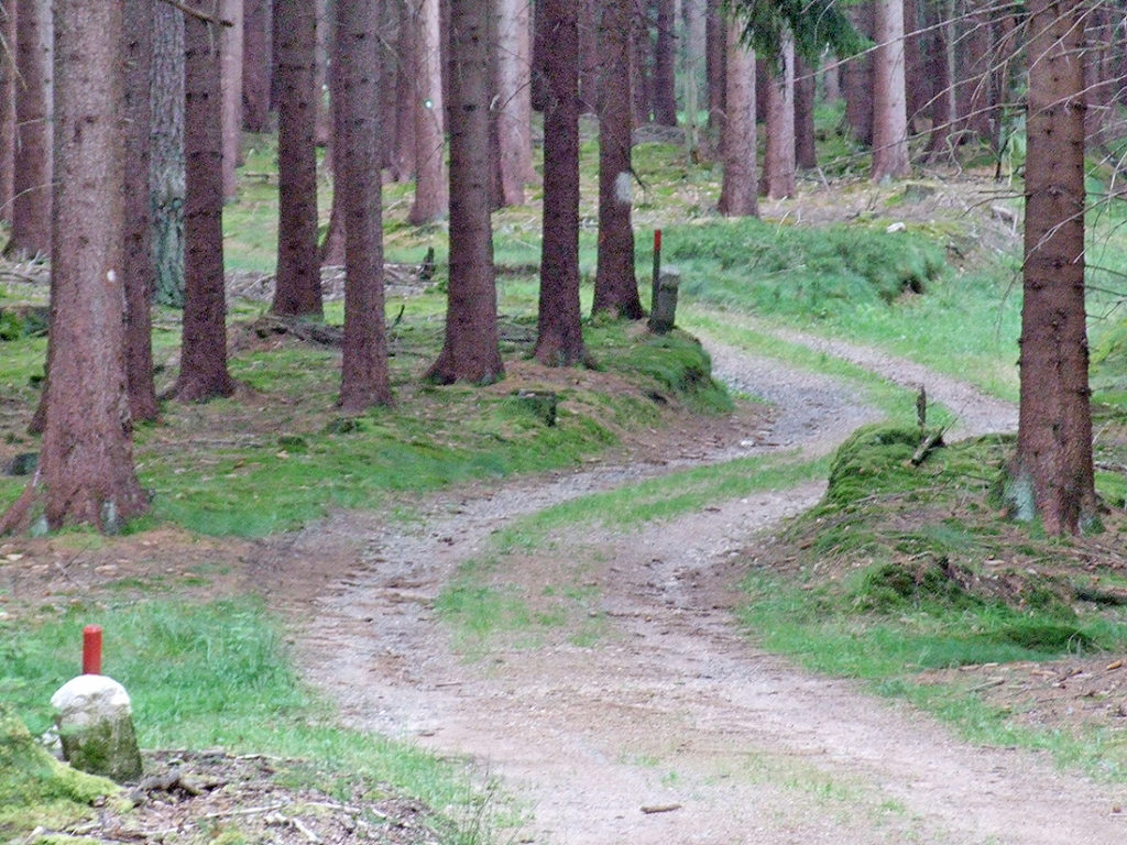
The Rinnlstein circular walking path located in the largest coherent forest area in northern Upper Palatinate (Oberpfalz). The forest stretches from south of the town Flossenbürg along the north-eastern edge of the Naab-Wondreb depression across the Czech Republic up to Bad Neualbenreuth and ends only west of the motorway A93. Together with its Czech counterpart, … Continue reading “Der Wald – The Forest (10)”
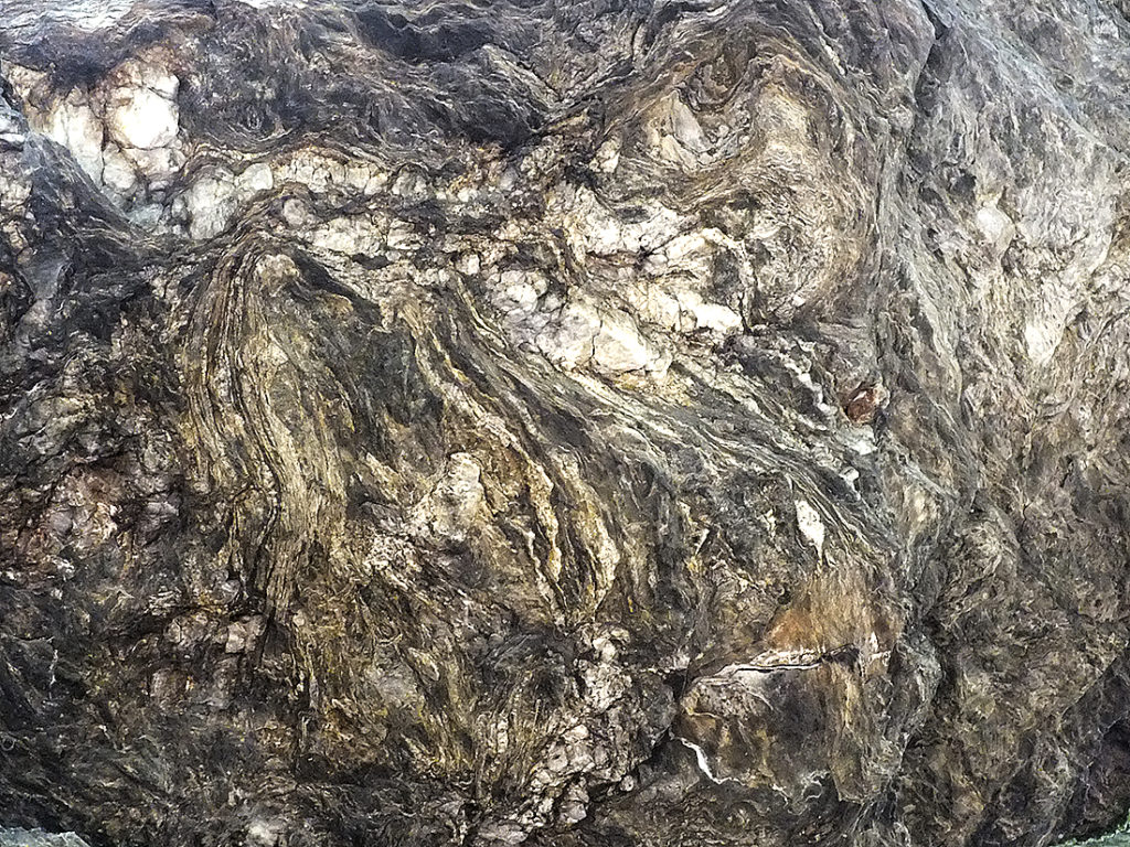
Schiefer, Quarz und Gold – Slate, Quartz and Gold (11)
The slate mountains of Waldsassen (“Waldsassener Schiefergebirge”) stretch across the border and cover an area of 500 square kilometers. From a geological point of view, it is divided into two different areas along a line between the villages of Leonberg and Dolni Zandov (CZ, “Unter-Sandau” in German). The younger area from the Ordovician (485 – … Continue reading “Schiefer, Quarz und Gold – Slate, Quartz and Gold (11)”
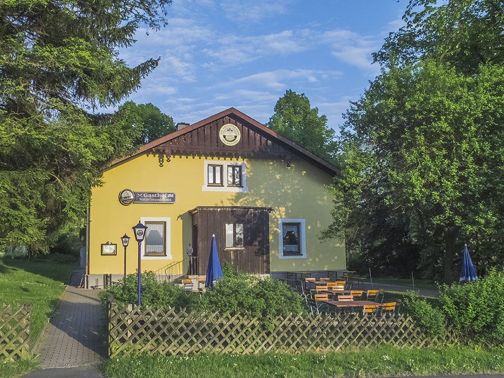
Das “Forsthaus” – The Forester´s House (12)
„Let’s go to the forester´s house“, people used to say in the past – and sometimes they even do today – not for nothing! The property, built in 1860 as “Royal Bavarian Forester´s House” on the outskirts of the village of Wernersreuth, was acquired by the nature lovers’ club “Naturfreunde Waldsassen” in the 1960s and … Continue reading “Das “Forsthaus” – The Forester´s House (12)”
The following link leads to outdooractive.com, where the route can be recalled, stored, printed or transferred to mobile devices:
© Marktgemeinde Bad Neualbenreuth; Änderungen vorbehalten; Stand: Juni 2018
The “Rinnlstein” hike consists of two circular routes (1 and 2) which together form a big eight. It is 9.5 km long. It is best if you walk along the course following the direction of the arrows. You can start on each of the three parking lots.
Alternatively, you can follow the path following the numbers of the “Historical Points” from 1 to 12.
Depending on your physical condition, it is also possible to divide the twelve stations into two rounds.
Info-flyer download: Info-Flyer_Rinnlstein-Rundweg.pdf (4.3 MiB, 1,768 hits)
Der “Böhmische” – The Bohemian Wind (1)
Like many other villages in the area of Bad Neualbenreuth, also Wernersreuth has a close connection to the monastery of Waldsassen. It was first documented in 1140 as “Wernherisrvte”. It lies 606 metres above sea level right in the middle of an ancient clearing area which slopes to the south. The ending “-reuth” derives from … Continue reading “Der “Böhmische” – The Bohemian Wind (1)”
Die Wasserspender – The Water Dispensers (2)
Around the “Birkenberg” and “Heidelberg” mountains you can find three productive spring grounds. The sources of the streams “Pointmühlbach” in the north-east, of the “Kornmühlbach” in the west and of the “Hendlmühlbach” in the south are supplied by the surface water of the wooded heights. On its way down, the surface water passes the slate … Continue reading “Die Wasserspender – The Water Dispensers (2)”
Am Heidelberg – On The “Heidelberg” mountain, 731 m (3)
On the summit of the “Heidelberg” mountain, next to the rock formations, you can find the remains of old gold mining tunnels (“test galleries”). In the Middle Ages, Bad Neualbenreuth was known for its rich gold deposits. The gold mineralized in the quartz veins in the slate of the “Waldsassener Schiefergebirge” mountain range. In the … Continue reading “Am Heidelberg – On The “Heidelberg” mountain, 731 m (3)”
Die “Rainbuche” – The Beech On The Border (4)
Until several years ago, the “Rainbuche”, a mighty old beech, stood at this unimpressive place on the historic road on the saddle between the “Birken-“ and “Heidelberg” mountains. Beeches for themselves are not very important as a natural monument. More important are their significance as pre-eminent solitary tree and their importance as landmark. The “Rainbuche”, too, … Continue reading “Die “Rainbuche” – The Beech On The Border (4)”
Am Birkenberg – On the “Birkenberg” mountain, 744 m (5)
The “Birkenberg” (744 m) is the 1168th-highest mountain in Bavaria and the 1658th-,highest mountain in Germany. In the administrative area of Bad Neualbenreuth the “Birkenberg” is the third-highest mountain after the “Muglberg” and the “Grünhau”. Originally, the name of the whole mountain range, together with the “Heidelberg”, was called “Hedelberg”. The name goes back to … Continue reading “Am Birkenberg – On the “Birkenberg” mountain, 744 m (5)”
“Egerer Stadtwald” – A Bohemian Forest In Bavaria (6)
This 634-ha large woodland has been owned by the town of Eger since 1544. Historically, this situation goes back to the times of the so called “Fraisch”. Because of the disbanding of the Bavarian “Nordgau” region in the 14th century an area with overlapping legal and jurisdictional competences arose and, with it, persistent arguments between … Continue reading “”Egerer Stadtwald” – A Bohemian Forest In Bavaria (6)”
Die Köhlerplätze im Gutswald – The Charcoal Makers’ Sites In The Estate’s Forest (7)
Along the forest and hiking trail, on the slope gently descending to the northeast, flat round, but overgrown places can be discerned. On a few hundred meters, at least nine of them are lined up here. They are old sites of charcoal or maybe pitch kilns which partly were used until the beginning of the … Continue reading “Die Köhlerplätze im Gutswald – The Charcoal Makers’ Sites In The Estate’s Forest (7)”
Das “Rinnl” – The Streamlet (8)
The small babbling streamlet rises only 30 meters higher, in the middle of the forest, at the so called “Rinnlbrunnen” (Rinnl well). Its source is one of the highest located springs of the whole ridge. In the Vienna State Treaty of 26 June 1862 it is described that “on the Tillenberg mountain the borderline was … Continue reading “Das “Rinnl” – The Streamlet (8)”
Ringelfelsen (Rinnlstein) – The “Ringel” Rock (“Rinnl” Stone), 653 m (9)
The “Ringelfelsen” (also “Rinnlstein” or “Ringelstein”), 653 meters above sea level, is the biggest rock formation in the local area and is part of the “Waldsassener Schiefergebirge” (slate mountains of Waldsassen). This Phyllites (metamorphic slates) were formed during the geological era of the Cambrian around 541 to 485,4 million years ago. In the east, they … Continue reading “Ringelfelsen (Rinnlstein) – The “Ringel” Rock (“Rinnl” Stone), 653 m (9)”
Der Wald – The Forest (10)
The Rinnlstein circular walking path located in the largest coherent forest area in northern Upper Palatinate (Oberpfalz). The forest stretches from south of the town Flossenbürg along the north-eastern edge of the Naab-Wondreb depression across the Czech Republic up to Bad Neualbenreuth and ends only west of the motorway A93. Together with its Czech counterpart, … Continue reading “Der Wald – The Forest (10)”
Schiefer, Quarz und Gold – Slate, Quartz and Gold (11)
The slate mountains of Waldsassen (“Waldsassener Schiefergebirge”) stretch across the border and cover an area of 500 square kilometers. From a geological point of view, it is divided into two different areas along a line between the villages of Leonberg and Dolni Zandov (CZ, “Unter-Sandau” in German). The younger area from the Ordovician (485 – … Continue reading “Schiefer, Quarz und Gold – Slate, Quartz and Gold (11)”
Das “Forsthaus” – The Forester´s House (12)
„Let’s go to the forester´s house“, people used to say in the past – and sometimes they even do today – not for nothing! The property, built in 1860 as “Royal Bavarian Forester´s House” on the outskirts of the village of Wernersreuth, was acquired by the nature lovers’ club “Naturfreunde Waldsassen” in the 1960s and … Continue reading “Das “Forsthaus” – The Forester´s House (12)”
The following link leads to outdooractive.com, where the route can be recalled, stored, printed or transferred to mobile devices:
© Marktgemeinde Bad Neualbenreuth; Änderungen vorbehalten; Stand: Juni 2018